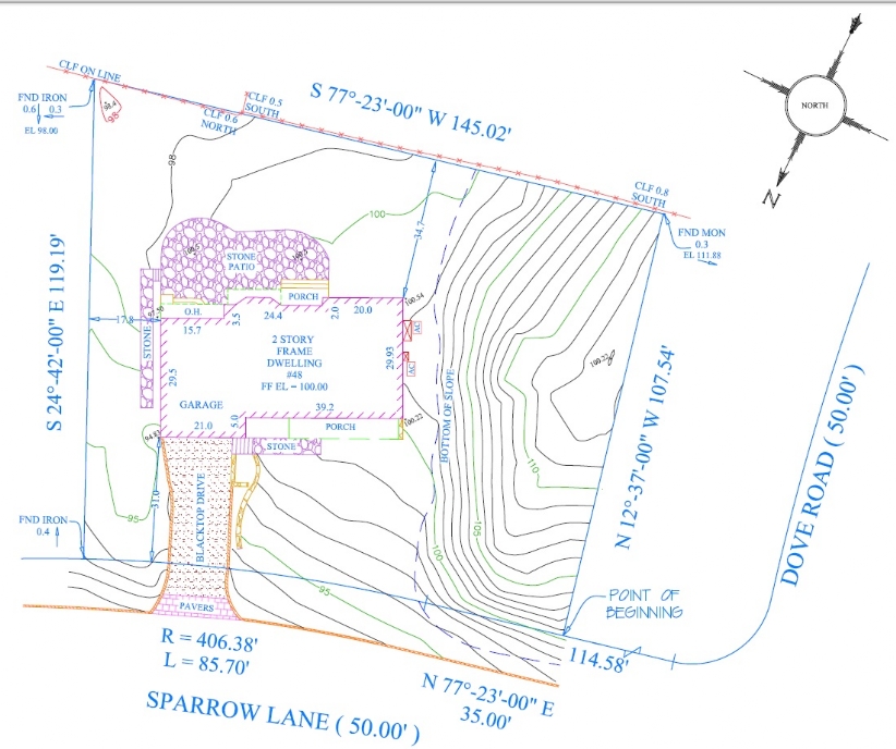
Topographic/Architectural Survey
A Topographic Survey is a survey that includes natural and man-made features such as: Buildings, Fences, Walls, Elevations, Land contours, Trees, Rivers, Streams.
A Topographic/Architectural survey is typically ordered by and Architect or Engineer. The completed survey will then be used by them to design and complete their project. Visible Surface utilities will be located such as utility valves, gas, water, and electric manholes. If a utility mark-out was performed then in addition to visible utilities the mark-out can be included on the map.
When Storm and Sanitary Sewer information is needed. They are located and then our crews will take physical measurements to determine the depth.
Sidewalk entities located include:
Pedestrian ramps, Utility poles, Mail boxes, Street signs, Curb cuts, Water meters, Light poles, Hydrants, Trees, Catch basins, Overhead utility lines, etc.
Sample of a Title Survey with Topography

